
When the atmospheric pressure is low, over large water body, which means temperature is more than 26.5 degree Celsius then they form up into a cyclone…
What is Cyclone?
CYCLONE: A cyclone is a general term used by meteorologist to describe any rotating, organized cloud that originates over water bodies.
Cyclones, Hurricanes, Typhoons; One Event but different names depending on the location. In the Atlantic and Northeast Pacific it is called Hurricane, in the Northwest Pacific it is termed as Typhoon and in the South Pacific and Indian Ocean, known as Cyclone

You can also classify them on the basis of hemisphere. Here, the northern one is Hurricanes and the southern one is cyclones. There are also a few difference in them apart from where they originated. Like the Cyclones are usually Clockwise while Hurricanes are Counter-clockwise.
TYPES: Cyclones generally occurs in 3 stages
- Tropical Cyclones, when a storm in a cyclone blows with speed of less than 74 miles per hour
- Severe Cyclones, when a cyclone gets instance and speed reaches between 75 to 120 miles per hour
- Super Cyclones, when the speed is more than 120 miles per hour
How Cyclones are formed?
When the atmospheric pressure is low, over large water body, which means temperature is more than 26.5 degree Celsius then they form up into a cyclone.
In other words, when the warm moist air over a large area of static ocean water rises upward from near the surface then they form into a cyclone. When the warm air rises up and away from the ocean surface, it creates an area of lower air pressure below.

It causes the air from surrounding areas, with high pressure to move towards low pressure area which further leads to warming up the new air and risible in order to fill the gaps, as the warm air continues to rise the surrounding air springs into take its place as warm moist air rises and cools off the water in the air forms cloud.
The whole system of clouds and wind spins and grow using warm and moist air as fuel and thus creating a spiral like structure. And this process is known as Cyclogenesis.
After that any air traveling into the low pressure area, has to join the spiral because the air cannot pass through the spiral directly. As the storm system rotates faster, an eye forms in the centre.
Cyclones die when they cross the land area. There is a misconception that the buildings on land stop the cyclone. But that’s not it Cyclones work with Moist warm Air.
At least 11,982 Tropical Cyclones are recorded in the Atlantic, Pacific and Indian Ocean. “Typhoon Tip” is said to be the largest and strongest Cyclone ever recorded in history.
Tropical Cyclones occur at the time of maximum solar radiation. In the northern hemisphere, it is during the period of July to October and the southern hemisphere, it is during the period of December to March
What is the Structure of Tropical Cyclone?

The wind field of a tropical cyclone may be divided into three regions; the Eye, the Eye-wall and the Spiral Rain Band.
- The eye is the area where the pressure is low and this part is normally calm. Also, this is the area of high pressure sinking air.
- The eye-wall is a dense cloud surrounding eye having maximum wind speed and it causes maximum destructions.
- The spiral rain bands are the band of clouds spiralling into eye-wall and it contains heavy rains.
The diameter of the Tropical Cyclone is typically around 200 to 500 kilometre but can reach 1000 kilometre and can grow up to a height of 10 kms.
Tropical Cyclone usually weakens when they hit land because they are no longer being fed by the energy from warm ocean water.
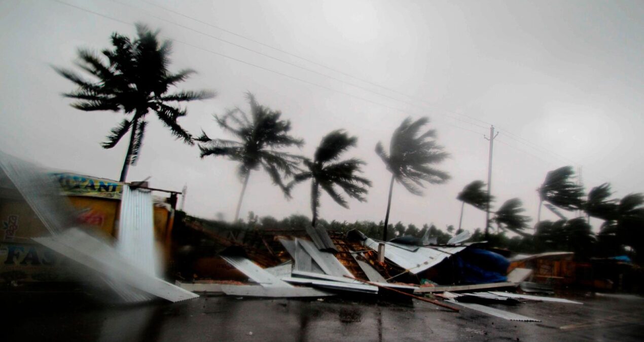
Why Cyclone Tauktae is Unique?
The NDRF has formed 100 teams and they are being deployed in the coastal regions of Gujarat, Maharashtra, Goa, Kerla, Karnataka and Tamil Nadu.
- Tauktae is the fourth cyclone in consecutive years to have developed in the Arabian Sea, that too in the pre-monsoon period (April to June).
- All these cyclones since 2018 have been categorised either “Severe Cyclone” or above.
- Once Tauktae makes its landfall, three of these will have hit either the Gujarat or Maharashtra coast. After Cyclone Mekanu in 2018, which struck Oman, Cyclone Vayu in 2019 struck Gujarat, followed by Cyclone Nisarga in 2020 that struck Maharashtra.
- Tauktae has been intensifying very rapidly. From a depression formed in the southeast Arabian Sea on May 14 morning, it strengthened into a VSCS by the early hours of May 16.
- Compared to Tauktae’s 2 days, Cyclone Vayu had taken 36 hours to become a VSCS, while Cyclone Mekanu (4 days) and Cyclone Nisarga (5 days) had developed slower.
- Also, the first cyclones to form in 2020 and 2021 were in the Arabian Sea during the Pre-monsoon period, both in the VSCS category.

Why it is having rapid intensification?
- Any tropical cyclone requires energy to stay alive. This energy is typically obtained from warm water and humid air over the tropical ocean.
- Currently, sea water up to depths of 50 meters has been very warm, supplying ample energy to enable the intensification of Cyclone Tauktae.
- The more the heat released through condensation of water vapour, the steeper the drop in pressure. A low-pressure system undergoes multiple stages of intensification to form cyclones.
- Typically, tropical cyclones in the North Indian Ocean region (Bay of Bengal and Arabian Sea) develop during the pre-monsoon and post-monsoon (October to December) periods.
- May-June and October-November are known to produce cyclones of severe intensity the affects the Indian coasts.
- Annually, five cyclones on average form in the Bay of Bengal and the Arabian Sea combined. Of these four develop in the Bay of Bengal, which is warmer than the Arabian Sea.
- In the Arabian Sea, cyclones typically develop over Lakshadweep area and largely traverse westwards, or away from India’s west coast.
A challenge with re-curving cyclones is that it is hard for weather models to pick them early on – as was the case with Ockhi – and so they pose unique challenges in terms of hazard preparedness and disaster management.
When a Cyclone is named and Why?
WHEN: Speed of a cyclone > 34 nautical miles per hour
WHY: Cyclones are named to:
- Reduce confusion
- Quick identification
- Easier for scientists to keep track
- Build up preparation
- Build up awareness
- Easier for media to report
How Cyclones are named? Who names INDIAN Cyclones?
It’s called the Hurricane if it occurs in the Atlantic, a Typhoon in the Pacific and a Cyclone in the Indian Ocean. And each time one of these strikes in the north Indian Ocean basin, the Indian Meteorological Department is ready with a name.
Now how that does happen?
The World Meteorological Organization has divided the world into nine zones. And picking a name for one of these extreme weather events depends on where it occurs. This process began for some regions in the early 1960s, but foe cyclones occurring in the north Indian Ocean basin it began only by the year 2000 and the Indian Meteorological Department was picked for the job. The eight countries from Oman to Thailand were asked to submit a list of 8 names each, which was done by 2004.
On the list, the countries are arranged in alphabetical order and the names are picked horizontally. This is why, cyclone Vardah that made landfall in Chennai in December 2016 was given a name suggested by Pakistan. The year 2017 began with cyclone Maarutha, the name suggested by Sri Lanka. Then came cyclone Mora, named by Thailand and at the end of the year came cyclone Ockhi, named by Bangladesh.
And even this process by the WMO was not free of controversy. In the 1960s, weather bureaus in different parts of the world picked only the names of women. The practise changed over a decade later after much protest by feminist organisations like the National Organisation for Women.
In 1978, the name and procedure for storms changed and included male names. And the year’s first tropical storm was given the name beginning with the letter ‘A’, second with letter ‘B’ and so on.
Also the name in the tropical cyclones is a recent phenomenon and the process of naming cyclones involves several countries in the region and is done under the ages of WMO.

So, for the Indian Ocean region deliberations for naming cyclone began in the year 2000 and a formula was agreed upon in year 2004. Later in 2018, five more countries were added.
World Meteorological Organization (WMO) member countries for the Indian Ocean region:
- India
- Sri Lanka
- Pakistan
- Yemen
- Saudi Arabia
- United Arab Emirates
- Qatar
- Bangladesh
- Iran
- Maldives
- Oman
- Thailand
- Myanmar
Naming process:
13 Countries suggest 13 names each: 13 lists * 13 names = 169 names
There are total 7 ocean regions around the world. Once the lists are exhausted, the panel decides a new list of names. Each region has different member countries.

Cyclones naming criteria:
- Name should be short
- Easy to pronounce
- Maximum permissible length is 8 letters
- No rudeness and cruelness
- Politically and culturally neutral
Other than all this even public also suggest names. The suggested names can be sent to the following address:
The Director General of Meteorology, India Meteorological Department, Mausam Bhawan, Lodi Road, New Delhi-110003.
Understanding Tropical Cyclones Categories
The northern coastline of Australia is one of the most cyclone-prone areas of the world. Communities in the region are threatened by tropical cyclones every season, with a very real risk to property and life.
A tropical cyclone’s effects vary depending on its intensity, so it’s important you understand the hazards involved and the potential damage a tropical cyclone can cause.
The intensity of tropical cyclones is described according to the numerical scale of 1 to 5, 5 being the highest rating.
These intensity ratings are based on the maximum wind gusts associated with the cyclone, which usually occur around the centre, known as the eye.
Tropical cyclones can intensify rapidly. There have even been occasions when a category 1 cyclone has become a category 5 within a day.
It’s essential that your plans to evacuate or take shelter are made well before the predicted arrival of the strongest winds.

- A category 1 tropical cyclone has estimated wind gusts up to 125 kilometres per hour. These winds speeds can damage crops, blow over small unsecured objects and cause boats to drag their moorings.
- A category 2 cyclone has estimated gusts between 125 and 164 kilometres per hour. These winds speeds will cause damage to homes, blow over large trees and make it dangerous to be outside.
- A category 3 cyclone has estimated gusts between 165 and 224 kilometres per hour. These destructive winds gusts can rip roofing from buildings, destroy caravans, cause large debris to fly through the air; and the risk of injury is real.
- If a cyclone reaches category 3 intensity, it is referred to as a severe tropical cyclone and is often the point when the characteristic eye of a cyclone will become clear on satellite images.
- A category 4 cyclone has estimated gusts of between 225 and 279 kilometres per hour. Theses winds are very destructive, causing significant roofing and structural damage to buildings, dangerous airborne debris and widespread power failures.
- A category 5 cyclone has estimated gusts of between 280 kilometres per hour and above. Winds at this speed are extremely dangerous and cause widespread destruction.
Along with powerful winds, tropical cyclones can bring heavy rain and storm surge, creating life-threatening situations in addition to the cyclone itself. Heavy rainfall can cause flooding, and it’s not always the case that the most intense cyclones bring the heaviest rainfall.
Storm surges associated with cyclones can have dangerous and devastating effects on coastal areas, with the level of inundation highly dependent on the tide levels around the time the cyclone crosses the coast.

All tropical cyclones are dangerous, regardless of their category; so be prepared, listen to local authorities and stay updated via the Bureau’s website to stay updated with the latest cyclone information.
Like what you read? do share with other and help them too… Also leave your suggestion for more such important information… Thanks for reading…


Nm
Thankyou for the information ? it will help a lot ?well written.
Sahil
Well written
Monu
??
Ritvik Shukla
???
Lucifer
Informative article..
Krishna Murari
??
Krishna Murari Mishra
??
MM Traders
????☔
Prerna Mishra
????